


Welcome to Touristl.
or
For faster login or register use your social account.
[fbl_login_button redirect="" hide_if_logged="" size="large" type="continue_with" show_face="true"]


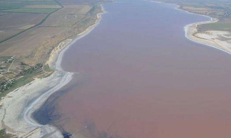
Once on the site of the Kuyalnik estuary there was the mouth of the river Big Kuyalnik. Over time, the mouth turned into the Gulf of the Black Sea, and then sediments of river and sea sand formed an embankment, and the bay turned into a liman.nSeparation from the sea occurred approximately in the XIV century.nThe water level in the estuary and its salinity regularly undergo changes. Long-term observations showed that in the period from 1878 to 1968, the salinity in the estuary ranged from 29 to 269 ppm. In years with high salinity, salt precipitated at the bottom of the estuary. In dry years, when the river Bolshoy Kuyalnik dried up, the area of the reservoir was almost halved. Three times – in 1907, 1925 and 2014 – to save the estuary from drying out, sea water was launched through specially dug canals.


For faster login or register use your social account.
[fbl_login_button redirect="" hide_if_logged="" size="large" type="continue_with" show_face="true"]
Add Review